
Exploring 3D Laser Scanning vs. 3D LiDAR Scanning: The Future of Digital Twin Creation
Introduction: A New Era in 3D Scanning Technology
As the demand for precise, immersive 3D representations of physical spaces grows across industries, the tools we use to capture this data are evolving. Whether for architecture, construction, real estate, or engineering, having accurate, detailed data is crucial for efficient project planning, collaboration, and execution. Traditionally, 3D Laser Scanning has been the industry standard for these needs. However, with the rise of 3D LiDAR Scanning, the landscape of 3D data capture is changing.
This article delves into the differences between traditional 3D laser scanning and the innovative 3D LiDAR scanning technology used by the Matterport Pro3. We’ll explore the benefits, drawbacks, industry applications, and scanning workflows to help you understand which technology best suits your needs and why Matterport’s approach offers a competitive edge.
What is 3D Laser Scanning?
3D laser scanning has long been a staple in industries requiring precise spatial data. This technology uses lasers to capture the shape and dimensions of an object or space, generating a highly accurate point cloud—a collection of data points that map out surfaces. Traditional 3D laser scanners typically rely on methods like time-of-flight or phase-shift scanning, which measure the time it takes for a laser beam to reflect off an object and return to the scanner.
3D laser scanning is widely used for tasks where high precision is essential, such as in industrial design, surveying, and infrastructure development. Its ability to create detailed 3D models makes it invaluable for projects requiring exact measurements and comprehensive spatial data.
What is 3D LiDAR Scanning?
3D LiDAR scanning represents the next evolution in spatial data capture. LiDAR, which stands for Light Detection and Ranging, uses pulses of light (often infrared) to measure distances and create detailed, three-dimensional maps of environments. The key difference between LiDAR and traditional laser scanning is LiDAR’s ability to perform accurately in diverse conditions, including varying light levels and complex geometries.
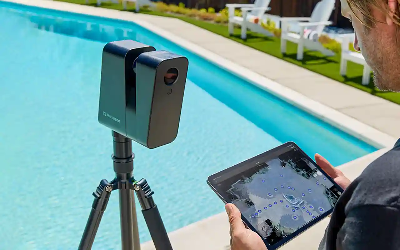
The Matterport Pro3 Camera exemplifies the power of 3D LiDAR scanning. By combining LiDAR technology with high-resolution imagery, it creates a detailed 3D digital twin—an interactive, immersive model of the scanned space. This blend of spatial accuracy and visual detail sets 3D LiDAR scanning apart from traditional methods, offering new possibilities for industries that require both precision and rich visualisation.
3D Laser Scanning vs. 3D LiDAR Scanning: A Comparative Analysis
Understanding the key differences between 3D laser scanning and 3D LiDAR scanning is crucial for selecting the right tool for your project:
- Accuracy and Precision: Both technologies offer high accuracy, but 3D laser scanners are often favoured for tasks requiring extreme precision over long distances. 3D LiDAR scanning, however, excels in capturing data in environments with complex geometries and varying lighting, providing a more versatile solution.
- Range and Versatility: While traditional 3D laser scanners might have an edge in specific industrial applications, 3D LiDAR scanning is more adaptable, functioning effectively indoors and outdoors, regardless of lighting conditions.
- Data Capture and Visualisation: 3D LiDAR scanning, especially with Matterport Pro3, stands out by integrating point cloud data with high-resolution imagery, resulting in an immersive digital twin. In contrast, traditional 3D laser scanning focuses primarily on spatial data, often requiring separate processes for visualisation.
- Use Case Flexibility: Traditional 3D laser scanning is ideal for environments where precise measurement is the primary goal. In contrast, 3D LiDAR scanning’s ability to combine spatial and visual data broadens its applications, making it suitable for real estate, construction, and virtual walkthroughs.
Benefits and Drawbacks: Choosing the Right Tool for the Job
Selecting between 3D laser scanning and 3D LiDAR scanning involves weighing the benefits and potential limitations of each technology:
- 3D LiDAR Scanning:
- Benefits: High accuracy, versatile data capture, integration of spatial and visual data, effective in challenging environments.
- Drawbacks: May offer slightly less precision over very long distances compared to specialised traditional scanners.
- 3D Laser Scanning:
- Benefits: Exceptional precision in specific industrial contexts, highly specialised for tasks requiring long-range accuracy.
- Drawbacks: Typically lacks integrated visual data, requiring additional steps for creating comprehensive 3D models.
File Outputs: What You Get from Each Technology
Understanding the types of files each scanning method produces is key to managing project workflows:
- 3D LiDAR Scanning Outputs: Common file formats include .LAS, .E57, and .OBJ, which are versatile for various applications, from CAD modelling to environmental analysis.
- 3D Laser Scanning Outputs: Traditional scanners often produce formats like .RCP, .PTS, and .PLY, which are focused on delivering dense point clouds but often need further processing for visualisation.
- Visualisation Capabilities: 3D LiDAR scanning, particularly with Matterport, excels by creating immersive digital twins that combine spatial data with high-resolution imagery, facilitating collaboration and decision-making.
Industry Applications: Who Benefits from 3D Laser Scanning and 3D LiDAR Scanning?
Both 3D laser scanning and 3D LiDAR scanning serve crucial roles across various industries:
- Architecture and Construction: 3D LiDAR scanning’s ability to create detailed digital twins makes it ideal for design, planning, and project management, while 3D laser scanning is used for precise site measurements.
- Real Estate and Facility Management: Matterport’s 3D LiDAR scanning enables the creation of interactive digital twins that enhance marketing, property management, and client engagement.
- Engineering and Infrastructure: Traditional 3D laser scanning is excellent for capturing detailed measurements in large-scale infrastructure projects, but 3D LiDAR scanning offers advantages in mapping complex environments.
- Historical Preservation and Archaeology: The detailed environmental capture provided by 3D LiDAR scanning is invaluable for preserving and studying historical sites, where both accuracy and context are crucial.
The Competitive Edge: Why Matterport’s 3D LiDAR Scanning Stands Out
The Matterport Pro3 camera’s use of 3D LiDAR scanning offers several unique advantages that provide a competitive edge:
- Digital Twin Creation: Matterport’s 3D LiDAR scanning creates comprehensive digital twins, seamlessly combining spatial data with high-resolution imagery, unlike traditional methods that focus solely on measurements.
- Collaboration and Visualisation: Matterport’s platform facilitates easy sharing, collaboration, and visualisation, making it simpler for teams to work together, regardless of their location.
- Workflow Efficiency: The integration of scanning, processing, and visualisation in one streamlined system reduces time and complexity, offering a faster and more efficient workflow compared to traditional methods.
- User-Friendliness: Matterport’s 3D LiDAR scanning technology is designed to be accessible and easy to use, requiring less specialised knowledge than traditional 3D laser scanning systems.
Scanning Workflow: How 3D LiDAR Changes the Game
The scanning workflow can vary significantly between traditional 3D laser scanning and 3D LiDAR scanning:
- Traditional 3D Laser Scanning Workflow: Typically involves multiple steps, including data capture, processing, and separate visualisation, which can be time-consuming and complex.
- 3D LiDAR Scanning with Matterport Pro3: Offers a more streamlined process, with integrated capture and visualisation, allowing users to move from scanning to sharing quickly and efficiently.
- Time and Cost Efficiency: Matterport’s all-in-one approach reduces the time and cost associated with scanning, processing, and delivering final outputs, making it an attractive option for many industries.
Conclusion: The Future of 3D Scanning is Here
As technology evolves, so do the tools available for capturing, analysing, and visualising the world around us. 3D LiDAR scanning, as implemented in the Matterport Pro3, represents a significant advancement in the field of 3D scanning. By combining the precision of point cloud data with high-resolution imagery, Matterport offers a comprehensive solution that outperforms traditional methods in many applications.
For businesses and professionals across architecture, construction, real estate, and beyond, Matterport’s 3D LiDAR scanning provides a unique competitive edge—delivering not just data, but actionable insights that drive better decisions, faster workflows, and more collaborative projects.
Contact Us
Ready to see how Matterport’s 3D LiDAR scanning can transform your next project? Contact our team today to learn more about our services or to schedule a consultation. Discover the future of 3D scanning and digital twin creation with 360 View.
To stay updated with the most interesting trends and news that will help you maximise your business’s online visibility, please connect with us on: Facebook, Instagram, LinkedIn, and X!
Explore more from 360 View: Matterport Digital Twins, 360 virtual tours for real estate, view our project portfolio.
Frequently Asked Questions
Can children appear in educational institution tours?
Yes, with proper institutional consent protocols. Schools typically have blanket consent or can exclude certain areas. Discuss your consent procedures with us before capture to ensure compliance.
How transparent are virtual tours about space quality?
Virtual tours honestly showcase your space. Quality tours highlight strengths, making customers feel confident. Honesty builds long-term trust and reduces complaints from mismatched expectations.
What’s the difference between Matterport and Google Street View?
Matterport creates a 3D digital twin with floor plans and measurements. Google Street View is a 2D navigable walkthrough published on Google Maps. Choose Matterport for detailed analysis or Google Street View for visibility and customer discovery.
Why not just use social media photos instead?
Social photos are snippets. Virtual tours create immersive 3D experiences that build trust and confidence. Customers spending 3+ minutes in a tour are significantly more likely to visit, enquire, or book.
Are 360 View tours compatible with all devices?
Yes. Tours are built with responsive design for phones, tablets, desktops, and VR headsets. Modern web standards ensure broad compatibility across platforms and browsers.


