Welcome To 360 View Virtual Tours UK
Google Street View, Matterport & Bespoke Virtual Tours Across the UK
360 View is a virtual tour company working across the whole UK. We create Google Street View virtual tours for Google Maps, Matterport digital twins, custom virtual tours, 360 photography and point cloud 3D scanning, so customers and teams can explore your space and decide from anywhere
Trusted by Organisations Across the UK
Teams choose 360 View when they need a dependable partner for capturing real environments with care, consistency, and control.
Our Services
Virtual Tour and 3D Scanning Services Across the UK
We capture and create immersive content that helps customers, teams and partners understand your space with clarity. Our services support clear decision making, stronger online visibility and better accessibility.
Indoor Google Street View
Outdoor Google Street View
Matterport Digital Twins
Point Cloud Scanning
Bespoke Virtual Tours
Immersive Wayfinding
Explore each service page for Google Street View and Matterport pricing, inclusions, and delivery timelines, or request a free quote for an exact figure.
Recent projects
See How Different Organisations Use Virtual Tours and 3D Capture
Our recent projects show what immersive spatial data looks like in practice. Real environments captured as clear, navigable, measurable references that can be used publicly for visibility and trust, or privately for operations and collaboration.
You will see projects across logistics sites, hospitals, universities, hotels, architectural workflows and public sector environments, delivered through Indoor and Outdoor Google Street View, Matterport digital twins, bespoke virtual tours, point cloud scanning and indoor wayfinding.

Virtual Tours for Complex Spaces of Any Size and Type

Best Google Street View Companies in the UK (2026): An Honest Comparison
Businesses on Google Street View Before and After: See the Difference

Private Matterport 3D Tour for a Large London Entertainment Venue

Recent Work: Logicor Park Altrincham, Manchester

Veteris Clapham: Improving Visibility and Wayfinding for a 24 Hour Emergency Hospital

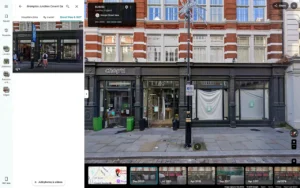
Deluxe Barbers Google Street View Tour

Logicor Park Derby Street View

London Private Hospital Google Virtual Tour: Helping Patients Explore Before They Visit
See how virtual tours and 3D capture are used across logistics, healthcare, education, hospitality, retail, corporate, and government environments.
Industries we support
Industries We Support Across the UK and Europe
Every Space Has A Different Purpose. The Right Virtual Tour Makes It Clear, Verifiable, And Easy To Work With.
🏭
Logistics Parks And Industrial Sites
Multi-building environments need clear navigation, site visibility, and reliable documentation. We capture large logistics and industrial sites so teams and visitors can understand access, layout, and scale fast.
🏥
Healthcare And Clinics
People need confidence before they arrive. We help healthcare and clinics make entrances, reception, corridors, and key facilities easy to understand, while respecting privacy and sensitive areas by design.
🏨
Hotels And Hospitality
Guests decide faster when they can see what the experience actually feels like. We capture rooms, public areas, and amenities for hotels and hospitality so the offer is clear before booking.
🛍️
Retail And Showrooms
A space can sell before someone steps inside. We help retail and showrooms customers explore layout, range, and atmosphere online, and help teams keep locations consistent across a portfolio.
🏢
Offices And Corporate Workspaces
Workplaces change often and teams work remotely. Digital twins and walkthroughs of corporate workspaces make planning, onboarding, and space decisions easier without constant site visits.
🎓
Education And Training Spaces
Campuses and facilities across universities and education are easier to navigate when they are visible online. We help students, visitors, and staff understand buildings, access points, and key areas in advance.
🏗️
Property, Construction, And Fit Out
Projects move faster when the site is measurable and shareable. We capture spaces for pre-site planning, documentation, progress context, and stakeholder alignment.
🏛️
Government And Public Sector Spaces
Public services need clarity and accessibility. We capture libraries, civic buildings, and public environments for government and public sector organisations so people can understand access, layout, and facilities with confidence.
Verified Client Reviews Across Europe
These reviews are pulled directly from our Google Business Profile. Read all Google reviews to see what organisations say about working with us.
Frequently Asked Questions
Answers to the most common questions about immersive spatial data, Google Street View, Matterport Digital Twins, and how we support clarity and visibility in an AI connected world.
What is a virtual tour and how does it help my business?
A virtual tour lets customers walk through your space online before they visit. It builds trust, answers questions early and helps people choose you with confidence. We create them with Google Street View, Matterport, 360 photography and bespoke tours.
Are you a Google Trusted Photographer?
Google retired the formal Trusted Photographer programme in 2024. However, 360 tours can still be published to Google Maps and Street View, and this is exactly what we specialise in. We use professional 360 equipment and specialist publishing software to create high-quality virtual tours for Google Business Profiles.
Do you create Google Street View tours, Matterport tours and 360 virtual tours?
Yes. We produce Indoor and Outdoor Google Street View, Matterport digital twins, bespoke branded virtual tours, 360 photography and point cloud scanning. One team covers everything from a single room to a full multi building site across the UK.
Can you capture large or multi-site locations across the UK?
Yes. We regularly capture multi building sites, large campuses and portfolios across the UK. We plan the route, capture on site and deliver a consistent set of tours for every location.
How much does Google Street View for my business cost?
For small businesses, our Google Street View virtual tours usually start from £247. The final price depends on the size of your space, the number of areas you want to include, and how many 360 panoramas are needed to create a smooth walk-through experience. After a quick review of your business, we can confirm the exact cost before booking.
How does a Google virtual tour help customers find and trust my business?
A Google Street View tour puts the inside of your business on Google Maps and Search. People can explore before they visit, which builds trust and helps your listing stand out. It also gives AI assistants real visual context about your space.
Which industries do you create virtual tours for?
We work with hotels, clinics, showrooms, retail, schools and universities, corporate offices, logistics sites and public spaces. The service is the same, the approach is tailored to your sector and what your customers need to see.
How long does it take to capture and publish a virtual tour?
Most small spaces are captured in a single visit and published within a few days. Larger or multi site projects take longer and are scheduled around you. We confirm exact timing with your quote.
Can a virtual tour help AI assistants and Google Maps recommend my business?
Yes. A virtual tour gives Google and AI assistants verified visual information about your space, so they can describe and recommend it with confidence. It makes your business easier to find, understand and trust online.
What do I need to prepare before you capture my space?
Very little. Have the space clean, tidy and well lit, and let your team know we are coming. We handle the planning, equipment and capture, and we send a short checklist before the visit.
Do you offer point cloud scanning and spatial data for construction and large estates?
Yes. Alongside virtual tours we provide point cloud scanning, digital twins and immersive spatial data for construction, universities, estates and multi site organisations. These advanced services support planning, documentation and facilities management. Ask us about your project.
✅ Didn’t see your question here? We’ll answer it personally, just get in touch.
Make Your Space Easy to Explore, Understand, and Trust
A simple, low-disruption process with no surprises. You share a few details. We handle capture, processing, privacy and delivery, and stay available if your space changes.
1. Tell Us About Your Space
Tell us the location, site type, and what you want the spatial data to achieve. Public or private. We’ll recommend the right approach and confirm clear deliverables and timeline.
2. We Capture and Build
We schedule around your operations and work efficiently on site. Privacy is planned upfront, including sensitive areas, exclusions, and controlled access. We then process and quality-check everything so it’s reliable and easy to use.
3. We Deliver and Support
You receive links, files, and access settings that are easy to share and manage. Your space becomes a trusted reference for customers, teams, stakeholders and AI systems, with support when updates are needed.